This Project aims at providing a simplified and straight forward way of providing GPS data while driving a vehicle. It uses an LED ring to point directions to the user and an OLED screen to display distance information. There are couple of more sensors such as APDS-9960 to sense ambient light, A 10 DOF IMU to receive feedback for the turns and acceleration. It is a smart device to be installed in your vehicle; The location data is received via blue tooth from a smart phone which this device is connected to.
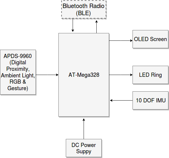
This is the Block Diagram of the Prototype hardware
Construction
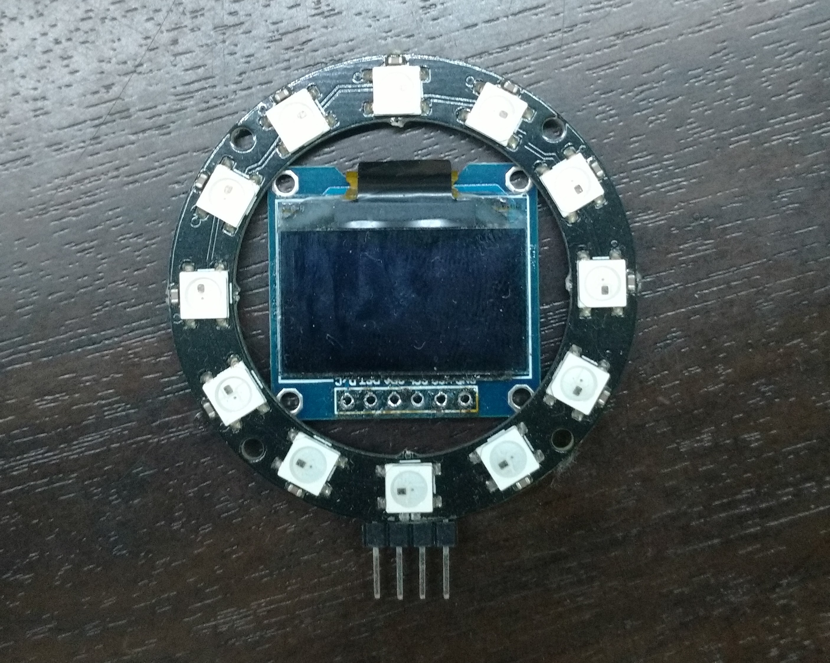
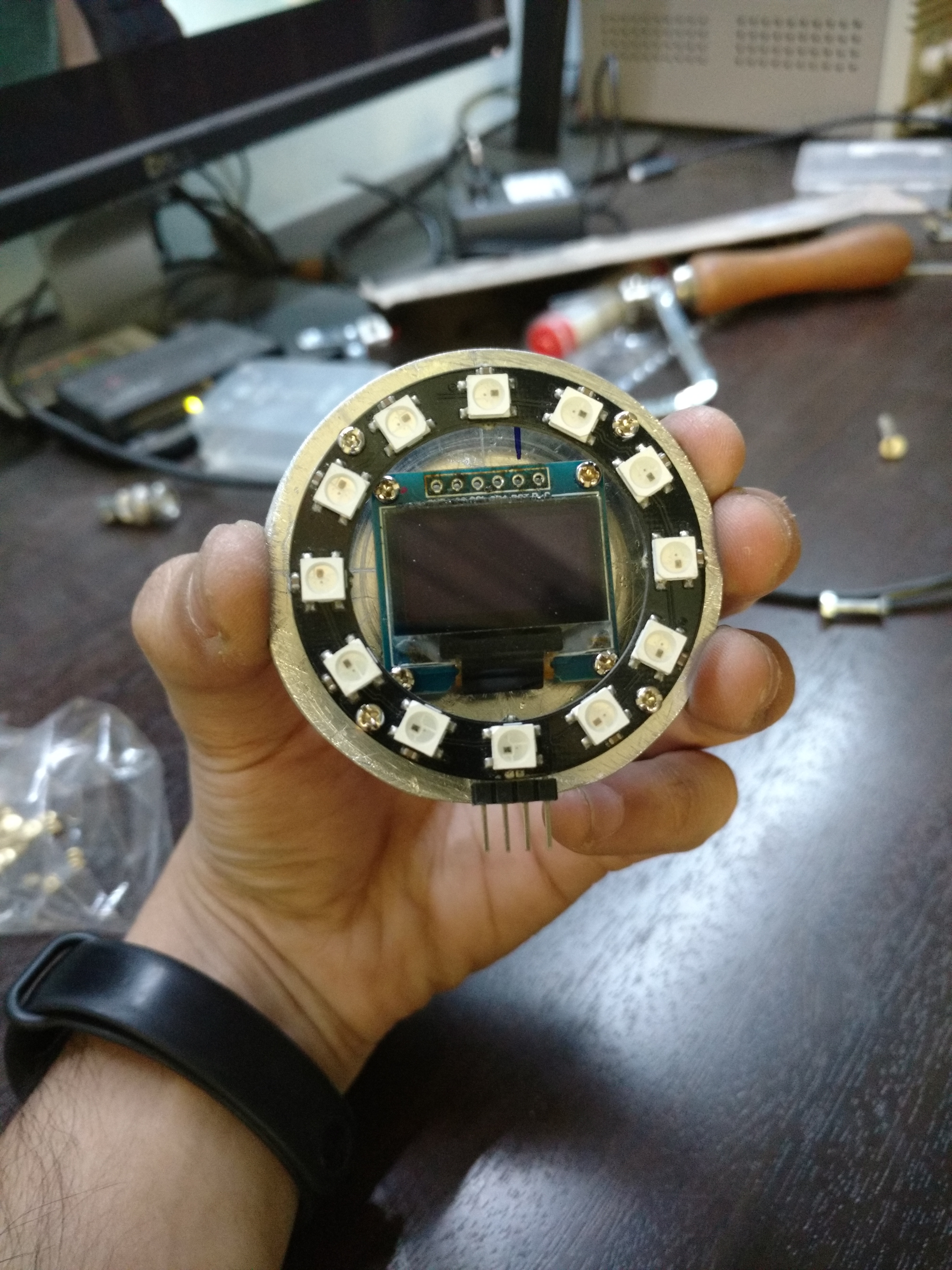
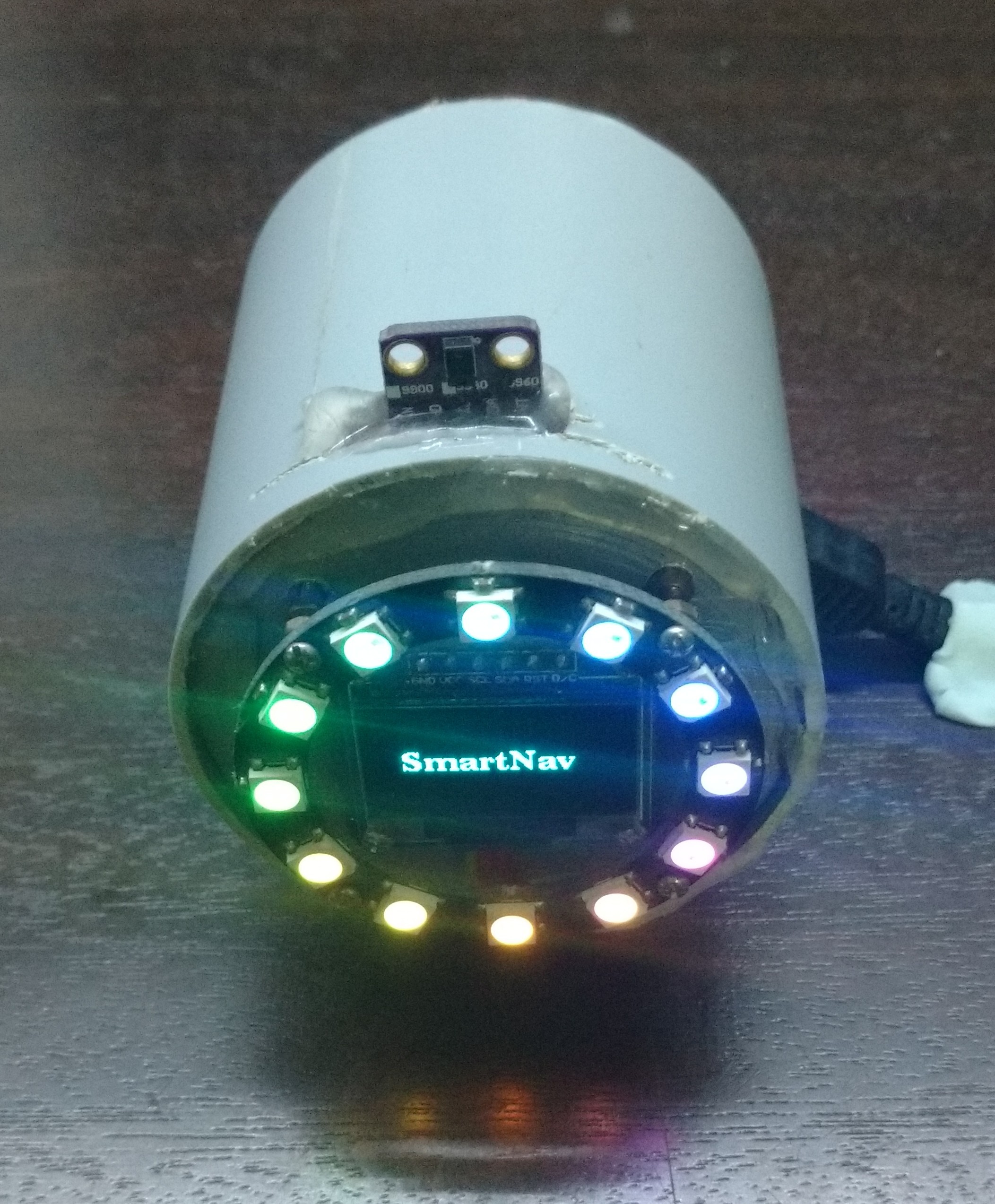
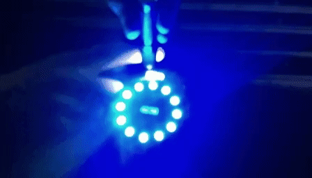
The Prototype
The APDS module has an ambient light sensor to adjust the brightness of the LED Ring to adapt to the car’s cabin conditions for the driver
This prototype device pairs up with our Android smart phone aplication and interprets directions for us.
The following is the flowchart of the Aplications working.

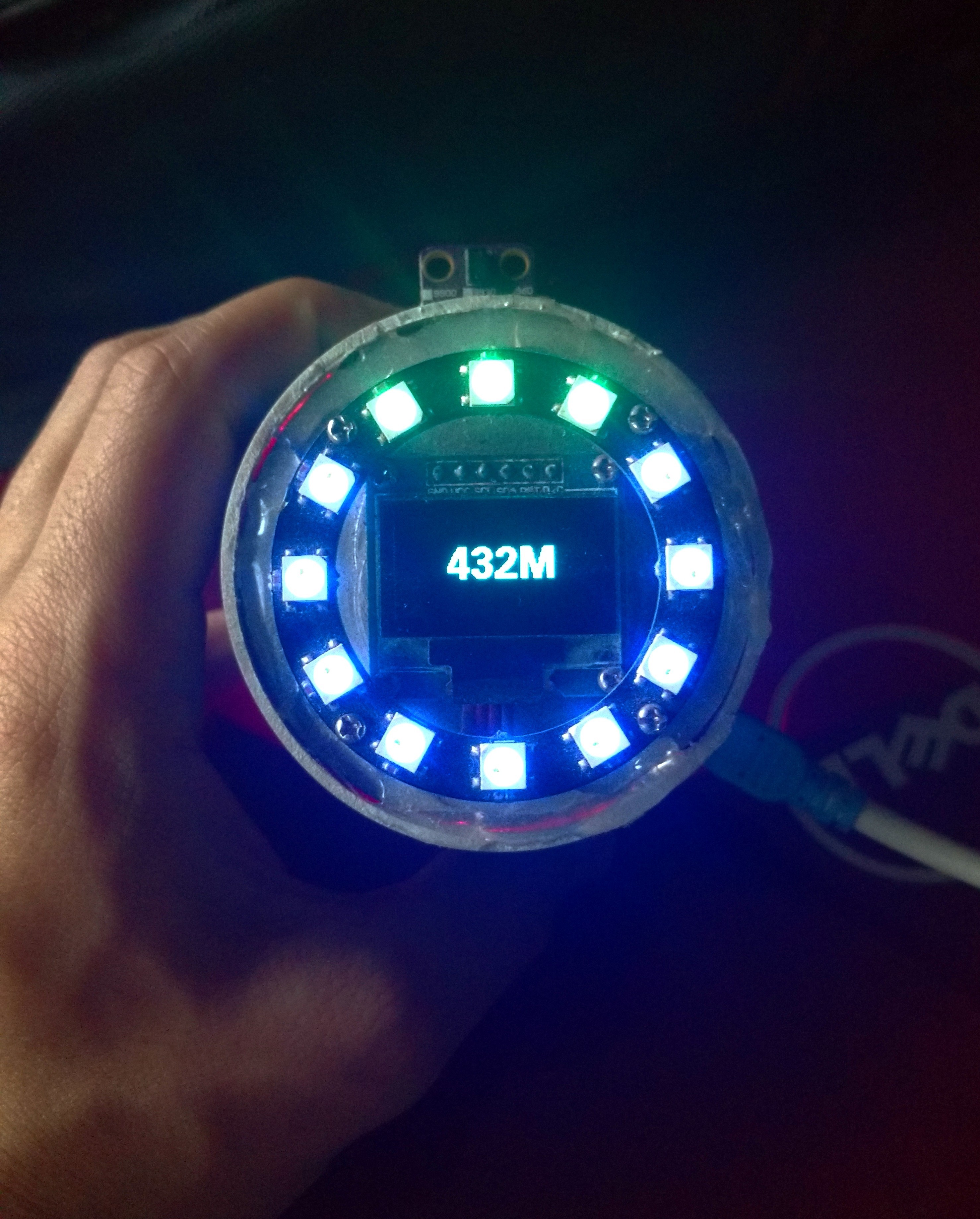
Head North for 432 Meters. Sample output of the device
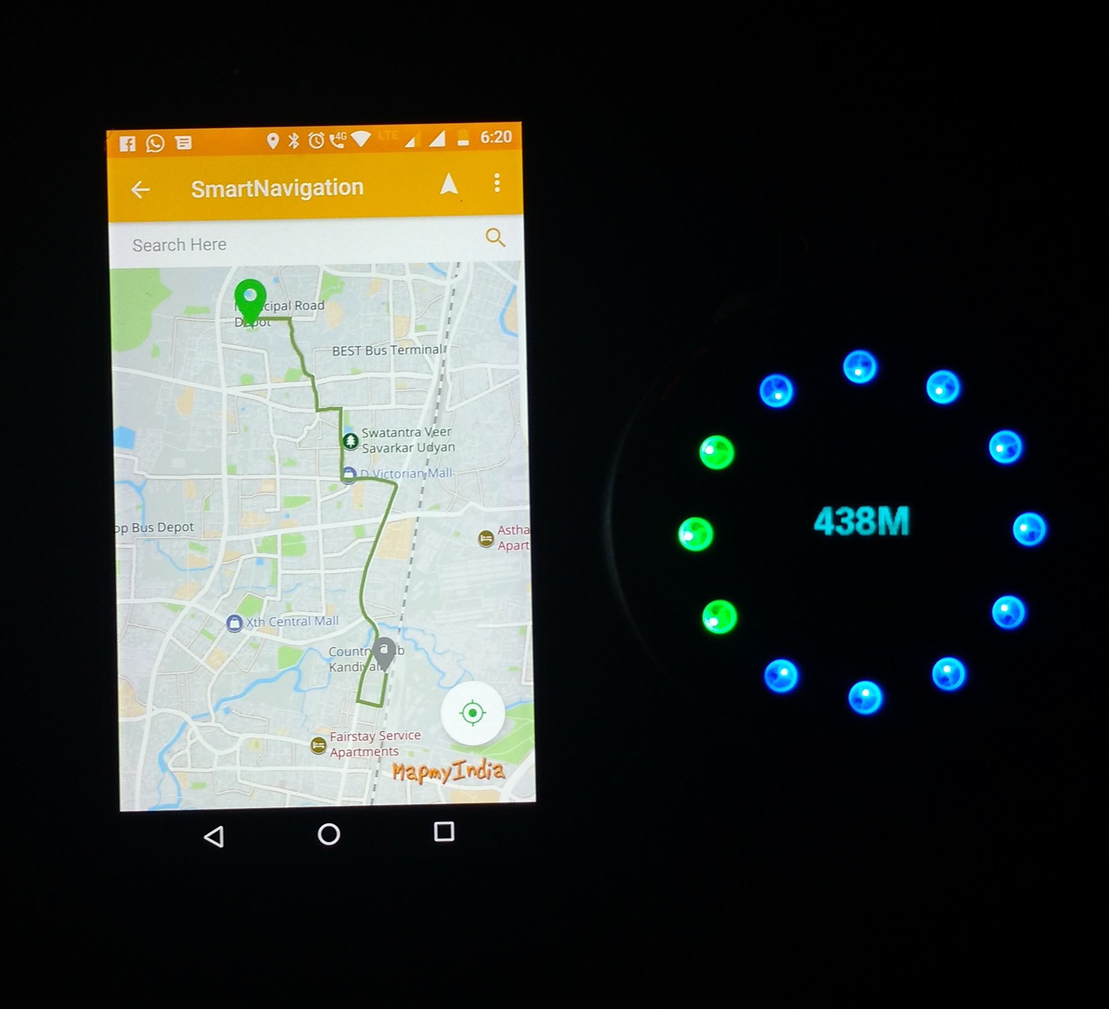
Device next to the application interface
Final Thoughts
This project was developed as a concept to simplify navigation in cities and to reduce the distraction faced by drivers in fiddling with phones while driving cars. Other features that can be added to enhance maps is to make complete use of the IMU to record potoholes and relay this information to put up alerts for other users.
Go Top